Saturday, February 16, 2019

Completing our Journey: Making it home and taking a look back

Hello and welcome back!
So sorry for the long delay since the last post. Things are very busy at the boat so finding time to edit these videos has been a challenge.

Video highlights from Victoria to Anacortes and a financial breakdown of our trip


A look back at our trip- Part 1 

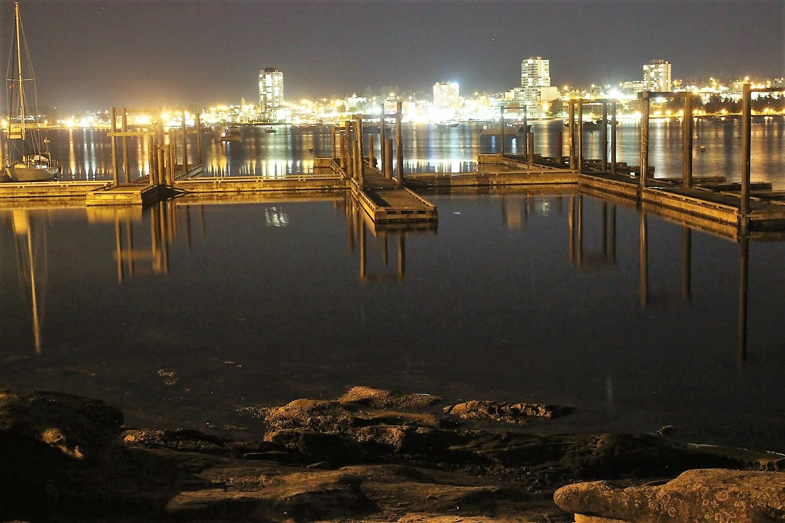
Anywho, we left you with us enjoying Victoria with friends and family. After a couple of really fun days we made our way back to The States. That portion of the trip was pretty uneventful: Customs was a breeze, weather was calm, and after two days we rolled back into our old slip in Anacortes.

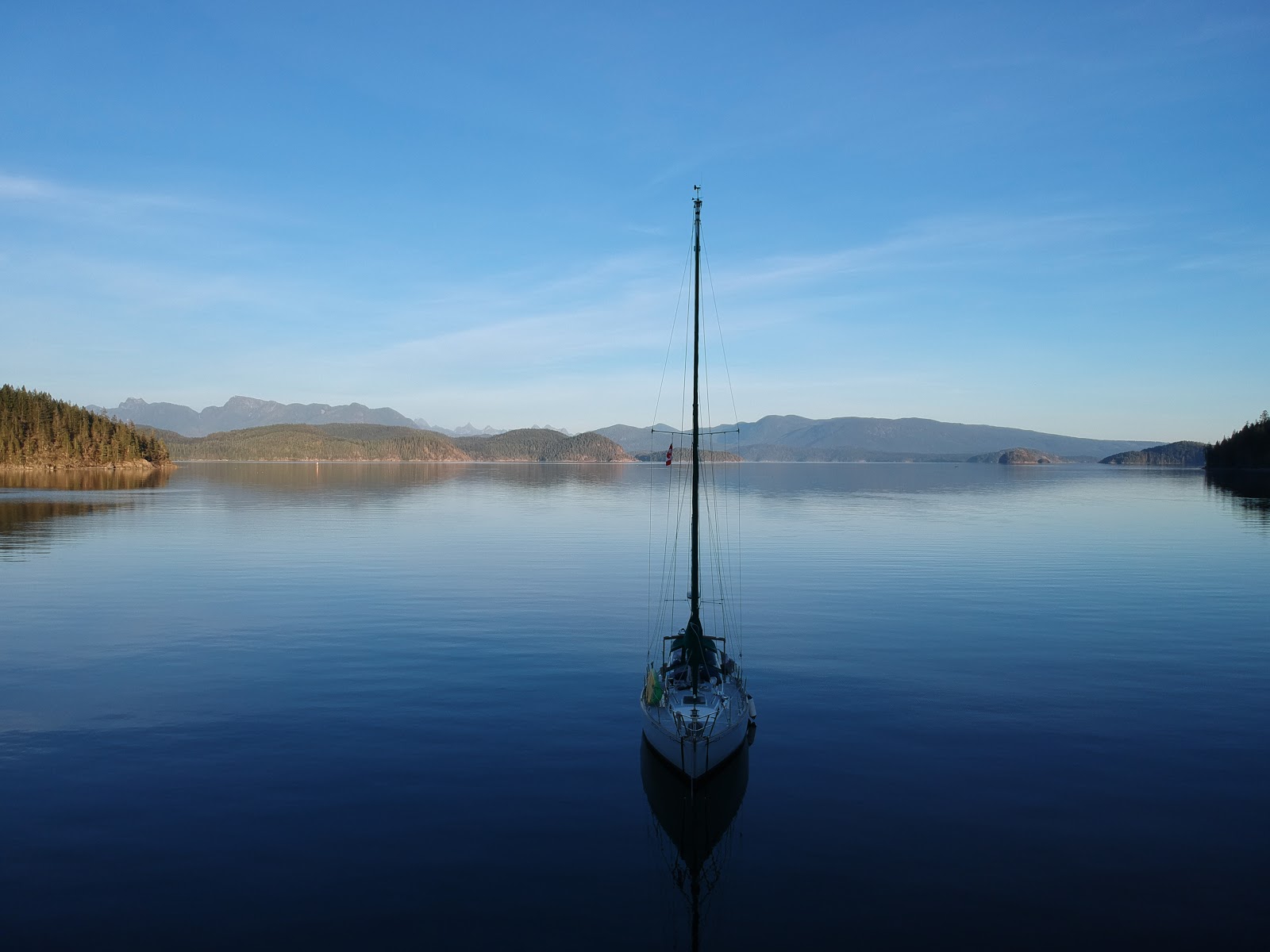
We learned so much on this trip that I could not possibly begin to explain everything. The biggest thing we learned is that we like cruising, and that WE CAN DO IT! We were total rookies at the start, never having dropped an anchor before, and 840 miles later we successfully made it back to our homeport. Now, we aren't experts or anything, but we gained so many skills and confidence in our abilities. We honestly didn't sail much (probably under 10% of the time), so we have a lot to learn there, but that's ok though because by motoring most of the way, that afforded us time to focus on other things such as the boat systems and navigation.

So yea.... Mission accomplished!

We landed back in Anacortes and got to organizing the boat and readjusting to life back at the dock. We learned a lot about the boat during our trip North. We got to know Maya a lot better and that allowed us to make a priority list of things that need to change on the boat. I'll briefly list out some of the main things we are going to work on over the winter:

  1. Leaky Portlights and Hatches (they basically all leak so those are going to need work)
  2. Plumbing issues. We discovered we were only using one tank of water (we have two) so a deeper dive is needed to look at why that is going on. Also, we have had issues with the vent line plugging.... lots of issues with the plumbing that we are going to look at.
  3. Some electrical things- sprucing some things up and making some small changes.
  4. Engine work- our engine is in great shape, but we are looking to add an anti-siphon loop which could potentially save the engine should we find ourselves in a following sea condition (I'll explain more in a upcoming blog post).
  5. Like a million other little things.

So those are the upcoming maintenance items we are going to look at (among others) during winter.

OK, so that about does it for this blog post. My apologies that this one is a little short and lacking in pics, but in place of those is a Part 1 of our trip recap video montage. Enjoy!

Thanks for stopping by and we hope to see you soon! Cheers!


Tuesday, January 8, 2019

Naniamo to Victoria- The Home Stretch of our of 2 month Journey!

Hello and welcome back to our journey through British Columbia! Previously, we had stopped in Naniamo after successfully crossing the Strait of Georgia- an 18 mile open water crossing. We pick up our story just after leaving Naniamo.


Video highlights from our travels from Naniamo to Victoria

Travel stats covered in this blogpost:
Distance: 69.8 Nautical Miles
Time spent traveling: Approx 15.5 hours
Duration: 6 days


The red line indicates our travel covered in this blog post

Google Map Locations (click to view on google maps):

We left Naniamo after spending two really great nights there. The anchorage and docks were basically deserted compared to when we were there about a month and a half earlier. We had anchored out the first night, but when wicked winds starting blowing in the morning, we opted to move to the deserted docks. Docks are THE BEST THING when you have a dog, because you get to skip all the rigmarole of getting Disco, you, and the dinghy ready to go to shore. So yea, we were psyched about the $15 dock spot. 

I know we have mentioned it before, but New Castle Island is AWESOME! It's huge, well kept, has showers, and no one is there! Perfect place for an off leash dog run around the island.... which is about 6 miles. Enough gushing... back to boating.

So we left Naniamo and headed towards Dodd Narrows, which is where changing tides squeeze water through a narrow opening, causing heavy current. We showed up on the North side of Dodd Narrows about 30 minutes prior to slack tide (no current) arriving. After waiting for the boats from the South catch the last of the dying tide going north, we caught the very beginning of the tide going south and safely transited Dodd Narrows!

We motored the rest of the way to Montegue Harbor, which seemed like a ghost town compared to when we were there about 7 weeks prior. Montegue Harbor is a huge, well protected bay, that's about 30' in depth everywhere- in other words it's a great anchorage.

Sunset at Montegue Harbor

Maya at anchor in Montegue Harbor

The colors were spectacular, but much different than a regular sunset 


We were heading south to Victoria to meet up with family for the weekend, so after one night in Montegue Harbor we continued south to Sidney Spit which has a great little beach and nice anchorage. Again, it was basically deserted, but I'm sure in mid summer it's jam packed due to its proximity to Sidney and Victoria. 

Sunset from Sidney Spit

Disco on the sandy beaches of Sidney Spit

Maya at anchor in Sidney Spit

The next morning we woke up to deteriorating weather, but decided to continue south regardless. South of Sidney Spit, two large bodies of water meet: Haro Strait and the Strait of Juan de Fuca. We were riding the tide south with wind blowing off of Juan de Fuca, which caused waves to stack up, making for an uncomfortable ride. Couple that with cold temps, hard rain, and a healthy bit of wind and needless to say it was kinda rough. Not in the sense that we were in danger... more like "I'm so ready to not be out here right now".

We managed to scoot past a point and tuck into Oak Bay, where we decided to drop the anchor. Unfortunately, ocean swell from that biting wind was coming straight into the bay causing us to pitch and roll.... screw that! We pulled up the anchor and made a final dash to Oak Bay where we picked up a slip for the evening.... hot showers cure all!

The next morning we made the final leg to Victoria under great weather conditions. We found our way to the Causeway Marina, which is in the heart of downtown Victoria. It's really awesome being able to park your house right in the middle of a major metropolitan town (for like $35 a night).

Pulling into Victoria... very busy waterway!

Our dock spot at the Causeway Marina

Empress Hotel in the background

The super famous Empress Hotel!

We met up with family and whipped up the town- touring local breweries and we even had a drink at the super fancy Empress Hotel. To make things even more fun we met up with French Canadian boaters, L'excursion, who we had met in Sidney Bay almost 2 months prior. It was so nice to see familiar faces in Victoria! 
Drinks at the Empress


Group shot!

Group selfie!

Craft Brewery Flight

Our friends, L'excursion, on the left. This is at an Irish bar in downtown Victoria

Disco dog not caring about being in front of a famous hotel

After a couple of whirlwind days in Victoria it was time for us to head back to the United States. The next blog will cover our last few days of our big trip along with what we had going on immediately after our arrival back to Anacortes.

As always, thank you so much for stopping by and reading. Please feel free to leave a comment/question and I will get back to you!

Thanks again and see you next time!

-Mac, Jenny, & Disco


Disco trying to stay warm in a pile of blankets.


Wednesday, December 26, 2018

Back in Desolation and Making Our Way Back South

Hello and welcome back to our journey through British Columbia! Previously, we had stopped in Squirrel Cove after successfully navigating several rapids in the Inside Passage. We pick up our story just after leaving Squirrel Cove.

Video highlights from Desolation Sound, Powell River, and Pender Harbor

Travel stats for travel covered in this blogpost:
Distance: 96.7 Nautical Miles
Time spent traveling: Approx 26.2 hours
Duration: 6 days


The red line indicates the our travel covered in this blog post


Google Map Locations (click to view on google maps):


From Squirrel Cove we decided to go back into the Desolation Marine Park to see what it was like this time of year. Based on the last few weeks of cruising we figured it would be deserted and that was indeed the case. We cruised into Tenedos Bay (same bay we anchored in on our way North).  We found a spot between an island and shore. The way the island was situated, we needed to run a stern line in order to not swing into rocks and a nearby shallow area. We probably would have been accosted anchoring like this in the summer as it took up lots of space, but we were Fall boating and had the whole place to ourselves! We had a fun evening drinking wine and trying to take night time photos of the boat. The photos didn't really turn out, but the wine tasted great.

On our way back into Desolation Sound


The following morning we left our anchorage under heavy fog. We had only experienced fog a few times on this trip so far, but we had already come to learn that we hate traveling in fog. When fog totally surrounds the boat, we don't have any point of reference to drive the boat from. That means that it's almost impossible to drive the boat in a straight line towards the destination. The chartplotter and compass help a bit, but we haven't found a good way to travel in fog yet. How they did it back in the time before chartplotters is a mystery to me (and incredible that they did it). The one good thing about fog is that it makes for some cool pics!


Maya at anchor with the fog rolling in


Fog filling up Tenedoes Bay


Leaving the anchorage under heavy fog

Thankfully the fog only lasted for about an hour and half before it burned off. What we were left with was a nice sunny trip towards Powell River, where we were planning on spending the night at the dock and meeting up with boater friends, Rheal and Julie, who we had met back in Sidney Bay. They live in an awesome house on a hill right above the marina. Happy hour and catching up were in order and that's what we did. Rheal and Julie, being the fantastic hosts that they are, let us do laundry at their house- what super hosts! They live right on the water and the view from Powell River is stunning- west facing over the Straight of Georgia.

Leaving the fog

Glad to be done with the fog!

Onwards to Powell River

The view from our friends' house. Great night!


We had a fantastic evening catching up with them- as if that wasn't enough they insisted that they drive us to the grocery store the following morning (we discovered that the store is NOT close to the water so they really helped us out!).
Power River was a great stop, thanks to the great hosts we had. It's funny we only knew Rheal and Julie for 2 days at Sidney Spit, but seeing them again in Powell River felt like we were old friends. I suppose that's a neat facet of boating- we're all out here because of the water, which gives us that common thread to bond over.

While in Powell River we checked the weather and saw winds and rain in the forecast. Wanting to make some miles south, we headed out and motored to our next anchorage, Pender Harbor. We had stayed at Pender Harbor on our way north, so it was nice to be familiar with the anchorage. Naturally, we had the entire anchorage to ourselves which was nice because we wanted to let out extra anchor chain for the winds expected overnight.

And we are so thankful we had that extra chain out because that night we experienced the highest winds of the trip. Holy S#$% did it blow! The storm was most intense in the wee hours of the morning, with winds gusting to 35-40 knots. Since we were in a cove, we were in a "wind eddie" so the boat was being blown back and forth. We were up several times that night checking on things, usually when a big wind gust would come through and shake the whole boat. Despite the chaos going on outside the boat, we did manage to sleep. We credit our ability to sleep to a handy phone app that we have. We have an "anchor watch" program that will tell us if Maya is out of the "anchor radius"... basically an alarm goes off if the boat drags anchor. The app also tracks where we have been and displays that in a map- allowing us to see what has been going on. It's so nice to wake up from a huge gust of wind and check our GPS location on the phone... saving us from getting out of bed and seeing if we were dragging anchor.


So we made it through the stormiest night of the trip, but the weather was forecasted to be rough off and on the next few days. We were headed across the Straight of Georgia to Naniamo, but were unsure of the sea conditions. The only way to check was to literally drive the boat out there so that's what we did. Somewhat surprised that the conditions were rather calm, we continued across and knocked out the 18 mile open water crossing. The last time we crossed the Straight of Georgia, the wind was howling and it was comfortable.... this crossing was rather boring, which is more than ok! After a long slog we had made it back to Nanaimo!


Rainbow from New Castle Island just outside Naniamo

Big city lights of Naniamo- we really liked Naniamo

Maya at the dock at New Castle Island


Thursday, December 13, 2018

Whitewater Rapids on the Ocean and the Last of the Inside Passage

Hello and welcome back! So sorry for the long delay since the last post!


Video highlights from this portion of the trip


Travel stats for travel covered in this blogpost:
Distance: 29.2 Nautical Miles
Time spent traveling: Approx 7.25 hours
Duration: 3 days


Zoomed in map of our travels- Blue indicates our path covered in this blog post

Google Map Locations (click to view on google maps):


Previously, we had just overcome Johnstone Strait on our return home. After a fantastic day sailing down Johnstone we stopped at Shoal Bay due to its proximity to our next objective: rapids.
After a quiet evening at Shoal Bay we took off early in order to time our arrival at several rapids.

We arrived at Dent Rapids a bit early, which provided the opportunity to fly the drone. I'm not sure if the video or pics demonstrate it, but in the area surrounding Dent Rapids, the water is very confused- meaning there's water going in every which direction- boiling up from the deep in all sorts of directions. Boils with heavy current lead to strong eddy lines that will push your boat around. It's exactly like what happens on a river. We didn't expect to use our whitewater skills out here, but being able to read the water and know what it's doing helped a bunch.

You can see the ripples in the water. That disturbance is caused by tidal current being squeezed through small areas, in some cases causing rapids.

Here we are just before entering Dent Rapids- you can see the lines on the water which is "confused water" caused by Dent Rapids

Maya continuing through Dent Rapids

Now, I've said all of that just to say we traversed the rapids fine. Again, it's all about timing your travel through the rapids at slack. Thankfully the next two rapids were close to the first, and we essentially rode the slack tide up, arriving at each rapid as slack arrived.
Those rapids were the last "gates" of the Inside Passage, and by passing those we were pretty much out of the IP. Almost immediately the weather was noticeably warmer and sunnier. We basked in the sun and warmth, steadily making miles to our next anchorage, which was Squirrel Cove.

Sunshine Selfie after passing through three rapids

Boat dog, Disco, loves sunshine!

Panorama enroute to Squirrel Cove

Getting the shot....

...of a giant spider!

Squirrel cove is basically a little hippie town on the little hippie island of Cortes. We parked the boat right in front of the main part of the town- picking the best spot because, again, we were the only boat anchored there! It's nuts (mind the crappy squirrel pun) how few boats are out cruising at this time of year. The weather was still quite warm and sunny and we soaked it up for all it was worth. Squirrel Cove sits on the west end of Desolation Sound, so it enjoys the same mountain view that can be found in the Desolation Sound anchorages. And what a view! Especially during the incredible sunset we had that night. It was super quiet out and the water was dead flat too, which gave a mirror effect to the water. One of the best sunsets of the trip.

Maya at anchor in Squirrel Cove

Maya at anchor in front of Squirrel Cove


A very calm evening and an amazing sunset at Squirrel Cove

Desolation Sound in the background

Sunset selfie

Disco dog during an amazing sunset

Sunset panorama

Sunset panorama

That's about it for this post. Please check back in soon for the next chapter in our adventure, where we battle fog, wind, and fall storms on our journey back home.
Thanks you for stopping by- we totally appreciate you following along!