Wednesday, December 26, 2018

Back in Desolation and Making Our Way Back South

Hello and welcome back to our journey through British Columbia! Previously, we had stopped in Squirrel Cove after successfully navigating several rapids in the Inside Passage. We pick up our story just after leaving Squirrel Cove.

Video highlights from Desolation Sound, Powell River, and Pender Harbor

Travel stats for travel covered in this blogpost:
Distance: 96.7 Nautical Miles
Time spent traveling: Approx 26.2 hours
Duration: 6 days


The red line indicates the our travel covered in this blog post


Google Map Locations (click to view on google maps):


From Squirrel Cove we decided to go back into the Desolation Marine Park to see what it was like this time of year. Based on the last few weeks of cruising we figured it would be deserted and that was indeed the case. We cruised into Tenedos Bay (same bay we anchored in on our way North).  We found a spot between an island and shore. The way the island was situated, we needed to run a stern line in order to not swing into rocks and a nearby shallow area. We probably would have been accosted anchoring like this in the summer as it took up lots of space, but we were Fall boating and had the whole place to ourselves! We had a fun evening drinking wine and trying to take night time photos of the boat. The photos didn't really turn out, but the wine tasted great.

On our way back into Desolation Sound


The following morning we left our anchorage under heavy fog. We had only experienced fog a few times on this trip so far, but we had already come to learn that we hate traveling in fog. When fog totally surrounds the boat, we don't have any point of reference to drive the boat from. That means that it's almost impossible to drive the boat in a straight line towards the destination. The chartplotter and compass help a bit, but we haven't found a good way to travel in fog yet. How they did it back in the time before chartplotters is a mystery to me (and incredible that they did it). The one good thing about fog is that it makes for some cool pics!


Maya at anchor with the fog rolling in


Fog filling up Tenedoes Bay


Leaving the anchorage under heavy fog

Thankfully the fog only lasted for about an hour and half before it burned off. What we were left with was a nice sunny trip towards Powell River, where we were planning on spending the night at the dock and meeting up with boater friends, Rheal and Julie, who we had met back in Sidney Bay. They live in an awesome house on a hill right above the marina. Happy hour and catching up were in order and that's what we did. Rheal and Julie, being the fantastic hosts that they are, let us do laundry at their house- what super hosts! They live right on the water and the view from Powell River is stunning- west facing over the Straight of Georgia.

Leaving the fog

Glad to be done with the fog!

Onwards to Powell River

The view from our friends' house. Great night!


We had a fantastic evening catching up with them- as if that wasn't enough they insisted that they drive us to the grocery store the following morning (we discovered that the store is NOT close to the water so they really helped us out!).
Power River was a great stop, thanks to the great hosts we had. It's funny we only knew Rheal and Julie for 2 days at Sidney Spit, but seeing them again in Powell River felt like we were old friends. I suppose that's a neat facet of boating- we're all out here because of the water, which gives us that common thread to bond over.

While in Powell River we checked the weather and saw winds and rain in the forecast. Wanting to make some miles south, we headed out and motored to our next anchorage, Pender Harbor. We had stayed at Pender Harbor on our way north, so it was nice to be familiar with the anchorage. Naturally, we had the entire anchorage to ourselves which was nice because we wanted to let out extra anchor chain for the winds expected overnight.

And we are so thankful we had that extra chain out because that night we experienced the highest winds of the trip. Holy S#$% did it blow! The storm was most intense in the wee hours of the morning, with winds gusting to 35-40 knots. Since we were in a cove, we were in a "wind eddie" so the boat was being blown back and forth. We were up several times that night checking on things, usually when a big wind gust would come through and shake the whole boat. Despite the chaos going on outside the boat, we did manage to sleep. We credit our ability to sleep to a handy phone app that we have. We have an "anchor watch" program that will tell us if Maya is out of the "anchor radius"... basically an alarm goes off if the boat drags anchor. The app also tracks where we have been and displays that in a map- allowing us to see what has been going on. It's so nice to wake up from a huge gust of wind and check our GPS location on the phone... saving us from getting out of bed and seeing if we were dragging anchor.


So we made it through the stormiest night of the trip, but the weather was forecasted to be rough off and on the next few days. We were headed across the Straight of Georgia to Naniamo, but were unsure of the sea conditions. The only way to check was to literally drive the boat out there so that's what we did. Somewhat surprised that the conditions were rather calm, we continued across and knocked out the 18 mile open water crossing. The last time we crossed the Straight of Georgia, the wind was howling and it was comfortable.... this crossing was rather boring, which is more than ok! After a long slog we had made it back to Nanaimo!


Rainbow from New Castle Island just outside Naniamo

Big city lights of Naniamo- we really liked Naniamo

Maya at the dock at New Castle Island


Thursday, December 13, 2018

Whitewater Rapids on the Ocean and the Last of the Inside Passage

Hello and welcome back! So sorry for the long delay since the last post!


Video highlights from this portion of the trip


Travel stats for travel covered in this blogpost:
Distance: 29.2 Nautical Miles
Time spent traveling: Approx 7.25 hours
Duration: 3 days


Zoomed in map of our travels- Blue indicates our path covered in this blog post

Google Map Locations (click to view on google maps):


Previously, we had just overcome Johnstone Strait on our return home. After a fantastic day sailing down Johnstone we stopped at Shoal Bay due to its proximity to our next objective: rapids.
After a quiet evening at Shoal Bay we took off early in order to time our arrival at several rapids.

We arrived at Dent Rapids a bit early, which provided the opportunity to fly the drone. I'm not sure if the video or pics demonstrate it, but in the area surrounding Dent Rapids, the water is very confused- meaning there's water going in every which direction- boiling up from the deep in all sorts of directions. Boils with heavy current lead to strong eddy lines that will push your boat around. It's exactly like what happens on a river. We didn't expect to use our whitewater skills out here, but being able to read the water and know what it's doing helped a bunch.

You can see the ripples in the water. That disturbance is caused by tidal current being squeezed through small areas, in some cases causing rapids.

Here we are just before entering Dent Rapids- you can see the lines on the water which is "confused water" caused by Dent Rapids

Maya continuing through Dent Rapids

Now, I've said all of that just to say we traversed the rapids fine. Again, it's all about timing your travel through the rapids at slack. Thankfully the next two rapids were close to the first, and we essentially rode the slack tide up, arriving at each rapid as slack arrived.
Those rapids were the last "gates" of the Inside Passage, and by passing those we were pretty much out of the IP. Almost immediately the weather was noticeably warmer and sunnier. We basked in the sun and warmth, steadily making miles to our next anchorage, which was Squirrel Cove.

Sunshine Selfie after passing through three rapids

Boat dog, Disco, loves sunshine!

Panorama enroute to Squirrel Cove

Getting the shot....

...of a giant spider!

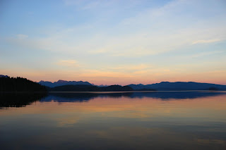
Squirrel cove is basically a little hippie town on the little hippie island of Cortes. We parked the boat right in front of the main part of the town- picking the best spot because, again, we were the only boat anchored there! It's nuts (mind the crappy squirrel pun) how few boats are out cruising at this time of year. The weather was still quite warm and sunny and we soaked it up for all it was worth. Squirrel Cove sits on the west end of Desolation Sound, so it enjoys the same mountain view that can be found in the Desolation Sound anchorages. And what a view! Especially during the incredible sunset we had that night. It was super quiet out and the water was dead flat too, which gave a mirror effect to the water. One of the best sunsets of the trip.

Maya at anchor in Squirrel Cove

Maya at anchor in front of Squirrel Cove


A very calm evening and an amazing sunset at Squirrel Cove

Desolation Sound in the background

Sunset selfie

Disco dog during an amazing sunset

Sunset panorama

Sunset panorama

That's about it for this post. Please check back in soon for the next chapter in our adventure, where we battle fog, wind, and fall storms on our journey back home.
Thanks you for stopping by- we totally appreciate you following along!

Tuesday, November 13, 2018

The Good and the Bad- Making our way down Johnstone Strait

Hello and welcome back to another chapter of our northern adventure!
We last left you at Port Harvey- We had spent an extra night there waiting out the crap weather in hopes of a more favorable wind direction and maybe some sunshine.... at least a little less rain!


Video Highlights from our journey down Johnstone Strait

Travel stats for travel covered in this blogpost:
Distance: 49.3 Nautical Miles
Time spent traveling: Approx 11 hours
Duration: 3 days


Zoomed in map of our travels- Orange indicates our path covered in this blog post


Google Map Locations (click to view on google maps):
Port Harvey
Port Nevelle
Helmcken Island
Shoal Bay


We spent a soggy evening in Port Harvey watching the original star wars movie (A New Hope) and awoke the next morning with.... a new hope! No rain and favorable wind! The detour to Port Harvey was definitely the right call. We made quick work of the 14 miles to Port Nevelle, pulling into the FREE government dock located there- love those free dock spots!
An abandoned Port Harvey

A sunny morning! We love the sun!

Upon arriving at Port Nevelle, we met another young person sailor- a rare thing, as the only people we had met on the trip so far were 50+. The sailor was a singlehander who was coming back from the summer in AK. Singlehander means they are the only person running the boat. A huge task that requires lots of skills! Naturally we were kindred spirits- happy hour and boat tours ensued!

Sunset show from our dock spot at Port Nevelle

The next day's plan was to make a long sail to Shoal Bay, but after meeting the singlehander, we opted to tag along with her, and anchor in the middle of Johnstone Strait, on Helmckin Island. It seemed like sleeping in the belly of the beast, but she was a sensei and we were the little grasshoppa.

We pulled out of Port Nevelle and did some downwind sailing! We were elated.... for about 10 minutes, until the wind cranked up to 30 knots with short choppy waves. SAILS DOWN IMMEDIATELY. So much for that idea. The angry sea conditions were caused by the wind blowing one way and the tide moving the other way. Wow it was nasty. We motored through the remainder of the unhappy sea until the tide changes and completely flattened out the water.

Rolly sea conditions in Johnstone

We anchored in Deer Cove on Helmcken Island. A short while after dropping the hook, the singlehander rolled in, along with another boat- friends of hers. Three boats of young cruising people?! What?! When it rain it pours (and it really rains up here)! The other two boats rafted up together and hosted happy hour and dinner! So much fun hanging out with fellow cruisers, trading stories, and seeing other boats and how they are set up. Super fun evening and we hope to see our new friends Fernweh and Vesi soon!

Helmcken Island is smack dab in the middle of Johnstone

Deer Cove on Helmcken Island. Vesi and Fernweh to the left and Maya on the right

Dog mission via the SUP- we had Rita Red stowed on deck and didn't feel like taking the time to take her down. The SUP works great a backup dinghy!

The next day we all took off at the same time, riding the flooding tide. The wind was from our stern so we enjoyed our first downwind sail of the trip! Seriously, the first one! It was so awesome sailing among our little convoy down the epic Johnstone Strait. Not to mention the sun was shining too.

Fantastic sailing conditions

That's us! Literally the only pic we have of us sailing- thank you SV Vesi for the photo!

We've had lots of great memories on this trip, but this stretch stands in with the best of them. After an awesome sail down the final stretch of Johnstone, we turned up Mayne Passage, wishing our new friends safe travels over the VHF. We were bound for Shoal Bay. We made it to the dock at Shoal Bay, which provided a good night's rest and a connection to internet. Internet is very scarce up here so you literally have to hunt it down.

That about does it for this blog post- join us next time as we prepare to travel through 3 sets of rapids all in the same day! Surely, you will want to know what happens next!

As always, thank you so much for stopping by and reading! Make sure to put your email address in the box on the upper left of the website.... by doing that you'll get an email notification every time we make another post!

Thanks again and cheers!

Monday, November 5, 2018

Kwatsi Bay, Matilpi, and Port Harvey

Hello and welcome back! In the last blog post we left you with a cliffhanger.... we were just leaving the safety of the dock not knowing if our alternator would charge our faulty batteries. We are back to answer that burning question!


Our travels in this blog post are depicted in green. (sorry it's getting a bit cluttered!)


Video Highlights from Kwatsi Bay, Matilpi, and Port Harvey

Travel stats for travel covered in this blogpost:
Distance: 49.6 Nautical Miles
Time spent traveling: Approx 13 hours
Duration: 4 days

Google map location links:
Link to Kwatsi Bay's location on Google Maps
Link to Matilpi's Location on Google Maps
Link to Port Harvey's Location on Google Maps

We left Pierre's early in the AM and headed east through the Tribune Channel towards our next destination, Kwatsi Bay. On the north side of Tribune Channel, a waterfall runs down into the ocean- a must see attraction! We pulled the boat as close to the land as we dared and set to taking pictures, flying the drone, and taking in the view. The Lacey waterfall is famous in the boating realm so it felt like we earned our "Lacey Waterfall Scout Badge" :-)


Lacey Waterfall from afar

Lacey Waterfall from close up!

Maya and Lacey Waterfall

Enjoying the view

Lovely scenery despite the weather

We continued on to Kwatsi Bay, where a wilderness marina is located (a wilderness marina is one that doesn't provide power). We had planned on on anchoring to save a few dollars, but it turns out it is damn near impossible to anchor in Kwatsi Bay! The bay's walls are basically vertical and that continues under water, which left us with very deep water very close to shore. We dropped our new analog depthsounder (our fishing pole) and attempted to find a suitable spot, but we couldn't find one, so we opted to pull up to the marina. After checking in and meeting the one other boat there we checked out the big waterfall next to the marina. It's worth noting at this point that "Kwatsi" means "pisspot" in the local native language. No doubt due to all the waterfalls that surround the bay! After the waterfall excursion we enjoyed a small happy hour gathering which consisted of us, the one other boater, Kerry, and the marina's owner, Max. A very nice evening spent chatting and watching the rain under a patio awning.


Rita Red in Kwatsi Bay

Maya at the dock in Kwatsi Bay

We hiked up to the waterfall!

Jenny for scale

Here's the marina at Kwatsi Bay- in mid summer this place is jam packed- not so much this time of year


The next morning we set out early to catch the flood tide moving east. It was pouring rain, and we had a long day of travel ahead of us- 30 miles with the winds not helping our cause. That day proved to be our coldest day on the water yet. After several hours of motoring, the wind picked up and allowed us to sail a bit. Although the combination of the wet, wind, and cold really started to get to us towards the end of the day. After a long, cold day we pulled into our next anchorage, Matilpi, which was an old native burial ground. Matilpi was located close to Johnstone Straight so it was a good jumping off point. Once the hook was dropped we got a fire going and cooked pizza- Jenny's sourdough pizza dough was amazing! We spent that evening staying inside and drying out by the fire.

Cold passage to Matilpi

And windy- brrrrr

Local resident towing a log boom

Rita Red at Matilpi with Maya in the background

Whoa that was some crazy wind!...... just kidding- our wind indicator is starting to act goofy and we did not experience hurricane force winds on our trip

The next morning we left Matilpi, bound for Port Nevelle, which is 14 miles east through Johnstone Straight. The forecast had called for crap weather, more rain and an unfavorable wind direction (coming from the direction we were headed). We left Matilpi under heavy rain, and after about 2 miles we both decided to bag the plan and pull into Port Harvey. This was the first time we had been to somewhere familiar- Port Harvey is the abandoned marina that we stayed at about a month prior. We tied up the deserted dock and hung out all day with the fire going. We are so thankful for that decision because that day proved to be the rainiest and nastiest day of the trip. Thank goodness we weren't out in Johnstone Straight!

Super neat boat we saw as we entered Port Harvey

Jenny and D Dog fishing from the dock at Port Harvey

Pretty sure Disco likes fishing more than us

Spirits were high despite the weather

Disco weathering the cold and rainy day at Port Harvey

Thank you for stopping by! Come by next time to see if that forecast was right as we enter the formidable Johnstone Straight.