Wednesday, August 29, 2018

The Straight of Georgia and The Sunshine Coast

We are back with another update! In this post we travel up the Sunshine Coast to Desolation Sound.

This blog post will cover our travels found on the map below:


Overview Map


We left you with us in Naniamo waiting to open our next gate.... the 18 mile crossing of the Straight of Georgia.

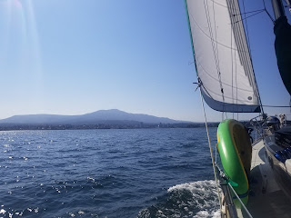
Unlike Dodd Narrows (our last gate), the Straight of Georgia is a huge, moody body of water. While Dodd Narrows was a 15 minute thing that you show up on time to, the Straight takes a boat like ours about 3 hours to cross and only can be done when the weather allows for it. The morning of our crossing called for 15 knot winds from the northwest, decreasing to 5 knots as the morning progressed. We left about 8AM with winds blowing a sustained 20 knots. Hmmm..... Even though the forecast was a bit off, we set out with a with a mix of apprehension, excitement, and determination.

Straight of Georgia crossing


Video highlights from our passage from Naniamo to Pender Harbor

Now we've sailed in 20 knots of wind before, but not in a body of water the size of the Straight.  We had planned on turning around if conditions were too nasty and we quickly realized that conditions were not comfortable, but we were determined to strech our abilities a bit- always knowing that if things got worse we could always turn around. Well, conditions held at 20 knots as we kept a port tack the entire time.... making the crossing in about 3 hours. Jenny drove the boat the entire way while I worked the sheets and threw up a bunch. Not only was this day a gate, but it was also the longest travel day we've had with Maya. From Naniamo to where we dropped the hook in Pender Harbor is 40 miles. A well deserved beer and early night was in order! A record day and gate unlocked- Hello Sunshine Coast!

With Desolation Sound in our sights we did not do much exploring in the Sunshine Coast. We cruised up the coast covering 20-30 miles a day, mostly by motor. Our stops were Pender Harbor, which is a well developed community with lots of marinas, houses, and seaplanes. Thankfully you can still anchor for free there- we love that! Our next stop along the sunshine coast was Blind Bay where our boat neighbors hooked (pun!) us up with some fishing tackle that we used to catch some rock fish- thank you Hank and Carolyn!  And our last stop on the the our of the Sunshine Coast was Lund.

Jenny with her first catch of the trip- thanks for the lure Hank and Carolyn!

Maya anchored in a small bay on Hardy Island

Jenny fishing for dinner


Lund, in addition to being the gateway to Desolation Sound, is the north terminus of Highway 101... a road that goes all way down to the southern tip of Chile. Kinda cool! Anywho, we needed to fill up on water, produce, and some other items prior to stepping into Desolation Sound. Expecting Lund to be a larger sized town we were a bit surprised when we pulled into a super tiny quaint community. Thankfully there was a general store there where we could reprovision, but holy hell the prices were nuts. Two bags of groceries with some beer? Yea, that'll be $200. Ouch. We're gonna enjoy the hell outta those beers. Lesson learned there- we will be provisioning differently next time.  Anywho, we took the opportunity to fill up our diesel tanks as well. Since leaving Anacortes we had only burned 20 gallons of fuel and didn't really need it (we 55 gallons capacity aboard), but we thought it wise to fill up when had the chance.... who knows how expensive it will be further north! A quick fun fact: a motor boat the same size as Maya would probably take somewhere in the neighborhood of 500 gallons of fuel to get from Anacortes to Lund.... sure they can get to their destination faster than us, but is it worth 480 gallons of fuel? We are very happy to have a slow boat.

Highlights from Blind Bay and Lund

Northern terminus of HWY101

Walk around Lund

Waterfront restaurant in Lund

Giant Chess!

We love chess!

With our diesel and water tanks full and our pantry stocked, we were finally ready to enter Desolation Sound! Wooohooo!!!

Stay tuned for the next blog post where we spend some quality time in Desolation Sound! Thanks for stopping by and reading about our adventure!


Tuesday, August 21, 2018

We made it to Canada!

Hello from Canada!
Sorry to have kept you all waiting for the newest blog entry! We are here to fill you in on what we have had going on since we arrived in Canada.

To make the jump into Canada we made a small 9 mile sail from Reid Harbor on Stuart Island to Bedwell Harbor on Pender Island. We cleared customs no problem- although we intitially tied up to the wrong dock and I walked through the marina to get to customs... which is apparently a big no no! Whoops! The customs agent took pity on me and gave me a small verbal warning for next time. Apparently what I did could result in a $1000 fine and being put on a "suspicous person" list in the Canadian system. That would be make for uncomfortable border crossings down the line.
Once we made it to the correct dock the check in process was quite easy. I walked to a phone bank at the end of the dock and picked up a handset. The line was a direct dial to a remote customs officer who asked me the regular passport info, a few questions about what we were bringing into the country, how long we were planning on staying, and then that was it. After the call the dockside agents gave us our pink Canadian tourist boat tag and that was it. Really easy- no cost, no fuss. Thanks Canada!


Crossing Haro Straight into Canada on a very calm day.

Raising the Canadian Flag- This flag is flown as a courtesy to country you are traveling in. The flag of the country the boat is registered in is flown aft.


Pretty much as soon as we arrived in Canada we made our way to Ganges on Salt Spring Island, which was a couple of hours by boat from Bedwell Harbor. We parked the boat for 5 or 6 days while Jenny attended Jessica (Jenny's cousin) and Rahul's wedding in Kansas City. Unfortunately, I could not make the wedding due to watching over the boat and Disco. However, I did make use of my time there by getting a bunch of odd jobs done on the boat during my time in Ganges.

I knocked out a bunch of little jobs: polishing some stainless steel, fixing the squeak here, another minor tweak there. Nothing too exciting, however I did manage to bust out the sewing machine and that was fun! It had been far too long since I've sewn anything and it felt great to turn the boat into an upholstery shop for a few days (bachelor pad/workshop meant the boat was a mess!). No major sewing projects, but I did make a bag for our windlass parts that can live up front now. The windlass levers were stored in a deep compartment in the back, while the windlass is in the front- usually ending up with a trip up and down the boat when anchoring. The other sewing project was some new winch covers, as the ones on the boat were looking RAGGED. It was nice to get some down time in to get of these jobs knocked out (and make that to do list a little smaller).

Boat life is growing on Disco

Parking for airplanes in Ganges- We are getting very used to seeing seaplanes around

Small bag attached to the mast that holds our tools for the windlass- no more trips up and down the boat when anchoring!

New winch cover on the right, old on the left


After a whirlwind weekend of traveling and celebrating at the wedding weekend in Kansas City, Jenny returned back to the boat. While we have loved our time in Canada so far, but I was happy to leave Ganges when Jenny came back. Ganges is the tourist hub of the Gulf Islands. It's pegged as a hippie dippie island town, but what I found was a super busy, kinda garbage-y (if that's a word) town. I ran most days I was there, but couldn't find a sidewalk or street was remotely friendly to pedestrians. Plus everyone drove like crazy people there! Where was everyone going in a such a hurry on a small island?! So much for island vibes....
I don't like complain here, but I had to give my honest opinion about Ganges- I don't want to sugar coat our experience. Anywho, anchors aweigh and moving on!

Once Jenny got back we quickly started sailing north again! From Ganges, we made a short trip to Montague Harbor on Galiano Island. While they are only a few miles apart, the islands were different worlds. The harbor is surrounded by a large park and a small waterfront restaurant. Montague Harbor is exactly what you think of when you hear "island vibe". Totally laid back, quiet, and clean. We only spent one night there, but managed to get a nice hike in at the park and then a beer at the bar. Met some nice people while we were there who offered us great fishing advice.
While brief, we really enjoyed our time in Montague Harbor.

Montague Harbor- lots of boats but plenty of space to park!

Evening hike in the park surrounding Montague Harbor

Cheers from Montague Harbor


From Montague we continued on to Herring Bay. This was a neat island that looked like it was in the Bahamas. White beaches and sandstone. We arrived in the morning and stayed until the following afternoon so we had time to SUP, crab, and explore this little island. Here's some pics and videos from that spot.


Herring Bay is awesome!

Lots of cool rock formations

SUPing around Herring Bay


So many shells

Selfie on Disappearing Island. It disappears when the tide comes in


We chose Herring bay because its proximity to our trip's first "gate".
The "gates" I'm referring to are challenging areas or spots that we need to traverse to continue north.

Our first gate was coming up: Dodd Narrows.

Dodd Narrows is a short passage narrow passage separating two large bodies of water. When the tide is full swing current can get up to 9 knots! For reference our boat goes about 5 knots at max speed! Boats have to time the tide right in order to safely traverse the narrows.
Thankfully, these times are well documented and published. We passed through the narrows with a group of 7 other sailboats just as slack tide was setting in. Gate unlocked!

Dodd Narrow is the gate between the Gulf Islands and Nanaimo/Straight of Georgia.

Nanaimo is a larger sized town on Vancouver Island and is a ferry ride away from Vancouver. While in Nanaimo we spent two nights moored in Mark Bay.

Mark Bay is formed by New Castle Island and Protection Island- New Castle Island is this INCREDIBLE park that is only accessed via boat. The park offered camping, kayaking, biking, tons of trails, etc. We frickin' loved it! Disco did too. The park was big enough so that you easily take your off leash and play fetch. We also got a fantastic trail run in around the outside of the island- at 6 miles around it was the perfect length for a run!
Another great thing about Mark Bay is that the Dinghy Dock Pub is located there, which is a world famous floating pub only accessible by boat! We grabbed seats at the bar and started chatting up our bar neighbor... turns out he was the owner! Had a good time talking with him while playing music trivia until way too late! We lost miserably at trivia, but had a great time!

It wasn't all play in Nanaimo though. We had a few chores to take care of.... most importantly we had to empty our composting toilet. It had been about two weeks and it was time. Nice thing about composting toilets is that its contents can be thrown away in the regular trash- the waste is essentially fertilizer/compost so it's all good. I'll admit it was a bit strange walking through town with a bag of toilet waste, but no one was the wiser! We even were able to find a free place to dump the waste (major score!).

Additionally, in Nanaimo we picked up some more fishing gear as we are going to try to start our luck (I think we are going to need it) at fishing. I'll try to update y'all with what our fishing setup in the next post.

And with our boxes checked in Nanaimo we are ready to take on our next Gate.... the 18 mile crossing over the Straight of Georgia. Stay tuned for more info and thanks so much for reading.

Sailing into Naniamo

The Dinghy Dock Pub

Don't mind us.... just taking care of business

Panorama from New Castle Park 

Sunset from Mark bay


Please feel free to comment or ask questions below!

Thursday, August 9, 2018

Let the adventure begin!

Hello everyone!
We are back with another update! We left off just after installing our new anchor system, which was the last thing keeping us in Anacortes. Again, we can't say enough good things about Anacortes. The weather, the crabbing, and the vibe is just great.
Evening crab pot run with happy hour drinks

Jenny with our dungeness dinner!

Here's a video of us crabbing

Summer weather in Anacortes.... hard to beat.

Provisioning for our Canadian Adventure

Since the last blog post, we extended our local cruising knowledge by getting out to more islands before making the jump to Canada. We also took care of the million different tasks required prior to leaving the country for several months.

In terms of stuff to take care of for the trip, there's the normal stuff... banking, addresses, phones, phone plans, bills, dog documents, voicemail, etc etc... but also tricky boat stuff like a Border Patrol Documentation sticker. Didn't know we needed that! We haven't really found a one stop shop that details everything you need so we have been piecing it together from various sources- our friends in Anacortes let us know about that all important Border Patrol sticker.... enough of Border Patrol.

We tackled all of those logistics and now we are ready to cruise!

Grocery Store on Shaw Island

Locals board at Ferry Terminal on Shaw Island- note the cash pinned to the board (you don't see that in city!)

Dinghy Dock on Shaw Island


The view from our anchorage in Blind Bay at Shaw Island

Evening hike in Blind Bay

Watmough Bay


 Cruise to the beach at Watmough Bay


We left Anacortes on August 3 and have been bopping around exploring new islands as well as some ones we've been to before.

Our first stop was Sucia Island, which we have been to numerous times over the years. This island is AMAZING! There's all sorts of bays and unique geology. Trails weave there way through the whole island- great trail running on Sucia that we took full advantage of.
Each bay offers something totally different even though it's the same island. This was probably our 7th trip to Sucia over the years, but we stayed in two new bays (Ewing Cove and Shallow Bay) during our time there.

From Ewing Cove we watched HUUUUGE bald eagles scoop up prey and eat it 100 feet from us (our mooring ball was close to shore).
Shallow Bay offered an incredible sunset as the bay sits on the western side of the Sucia that is open to Haro Straight (a big body of water). We watched fisherman troll for salmon just outside the bay- next time we will be ready with a fishing pole.

Celebrating our first day out on our northern adventure


Small example of the cool rock formations all over Sucia- Sandstone that has been pummeled by the elements for years and years


Ewing Cove


Panorama of Ewing Cove

Lighthouse at Patos Island. We tried to stay in the little bay there, but it was filled up with boats. We shall return!

Happy hour and chess in Shallow Bay- waiting for the sunset show to start.

Here's the show! Sunset from Shallow Bay on Sucia- hard to beat.

Trail Run views

Funny story: Imagine this spot as the sun was setting- the sea and sky were gold and shimmery. Years ago I had planned on proposing to Jenny on this trip and this was the perfect place....

Except I forgot the ring back at camp- DOH! It all worked out in the end :-)


From Sucia we rode the tide southward to Garrison Bay San Juan Island via Mosquito Pass. Garrison Bay is a little area tucked back in on San Juan Island. There's a a National Historical Park there that has a well preserved English army camp there that dates back to  the 1850's.

Apparently there were some disputes over land claims in the islands which had the US and England at odds during this time- so much so, that the two countries almost went to war over a pig! Somehow the situation got resolved (and the pig was eaten, no doubt).
It was funny reading the signs and historical info on the site- the British frickin' loved it at Garrison Bay! They said it was paradise, to which we agree!
While at Garrison Bay we did a quick hike to the top of Young Hill and even got a drone shot- check it out!

Timelapse of our traverse through Mosquito Pass


Drone shot from Young Hill on San Juan Island


Drone footage over Garrison Bay and Wescott Bay on San Juan Island

Here's some more information on that park and its history:
National Park Information Page
Wikipedia Article about English Camp

Young Hill overlooking Haro Straight and Canada

English Camp National Historical Site

This was also at English Camp, although I'm guessing the Brits didn't build this :-)

Another neat thing about Garrison Bay is that it's neighbors with Wescott Bay, which is world famous for its shellfish. We had Maya anchored in Garrison Bay, but were able to motor over to the Wescott Bay Shellfish Farm and Restaurant for an unforgettable lunch. BBQ Oysters that were in the water that morning (like 100 feet away!). Absolutely delicious. Highly recommend!

Dinghy Dock at Wescott Bay

Wescott Bay Shellfish Farm and Restaurant 

With a checked box next to Garrison and Wescott Bays, we had pretty much knocked out all the "MUST DO AND SEE" in the San Juan Islands. Note: this has taken us years of exploring the San Juans (this place is amazing!).
While we are certain there are many more hidden gems in the San Juan Islands, it was feeling like we were ready to taken on Canada!

Filled up on fresh shellfish we headed out into Haro Straight for a quick trip to Reid Harbor on Stuart Island to set us up nicely for a short crossing into Bedwell Harbor on Pender Island to check into Canadians Customs.

Stay tuned for our next post where we will be coming at ya from Canada!

Love that feeling!

Pretty sure this was a speed record for us. 

That "get-me-off-this-F#$%ing-boat" look.

Maya at anchor in Reid Harbor on Stuart Island- last stop before Canada


Thanks for following along (don't mind the pun)

A few more ramblings about our anchor setup...

With our new anchor setup we have continued to practice our anchoring skills. Having VERY limited experience with anchoring kicks the difficulty level up a notch, so each drop of the anchor is something of an adventure. It's a two person job with one of us at the bow and the other at the helm. Basically the person up front drops the anchor till it hits the bottom, then the helms person slowly reverses while more chain (also called anchor rode or just rode) is payed out. Once the correct length of rode is payed out (which changes based on depth of water and the weather) we connect a bridle to the chain, which acts as a shock absorber in between the boat and the chain- otherwise all the pressure of the boat being pushed is directly on our nice windlass.
So far, we have been pretty successful at dropping and retrieving our anchors. Many cruisers will set their anchor and dive on it to make sure that its set properly. Murky water and frigid water temps don't allow us to see what's going on so that makes it tough to know what's happening down there. Once we have our anchor and bridle system in place, we jam the boat in reverse - pulling the anchor back to dig the point into the ground firmly setting it. We've had to drop and pull our anchor up a few times in a row due to something going wrong (probably operator error), and we even pulled up an old sunken crab trap!
Our favorite part about anchoring is the fact that it opens up a whole world of possibilities it terms of places to stay. Anchoring is free and allowed pretty much everywhere so with a good anchor setup the world is your oyster (still have those Wescott Bay oysters on my mind). We are very happy with our anchor investment so far.


Our new anchor system at work- you can see the chain going over the bow roller. The bridle consists of the black lines on either side. Those lines attach to cleats on the boat- this allows those cleats to take the strain on the anchor chain as opposed to the windlass taking that pressure.